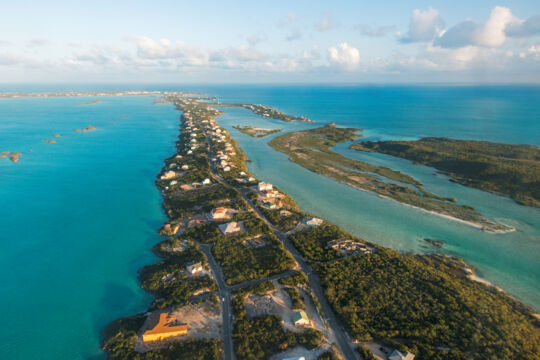
Turtle Cove on the central north coast is where the tourism industry began on Providenciales in the 1970s with the construction of the Third Turtle Inn. Providenciales is the third-largest island in the Turks and Caicos and has a total landmass of approximately 37 square miles (98 km²). The length from end to end is about 15 miles (24 km), and the width ranges from 1.5 miles (2.5 km) to 8 miles (13 km). Providenciales has a population of 47,720 people, according to a 2022 government estimate.
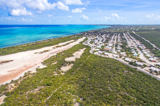
Much of the island’s development, including the tourism enclaves of Grace Bay , Leeward , Long Bay , the Bight , and Turtle Cove , is found in the eastern and central regions of the island.
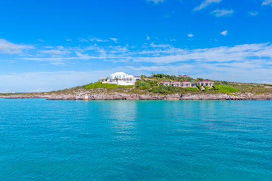
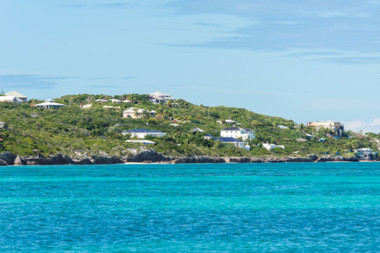
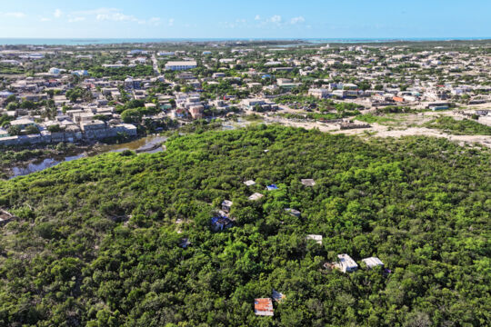
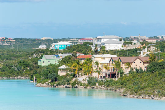
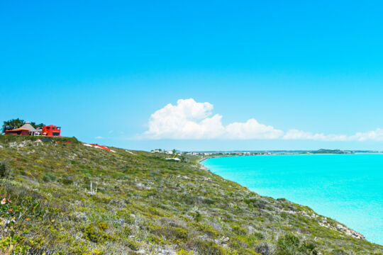
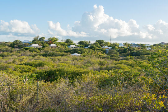
The western half of Providenciales remains largely undeveloped, though luxury villas and developments can be found in the Sapodilla Bay and Chalk Sound areas. Western Providenciales is home to several protected areas, including the Frenchman’s Creek and Pigeon Pond Nature Reserve , the Northwest Point Pond Nature Reserve , and Chalk Sound National Park .
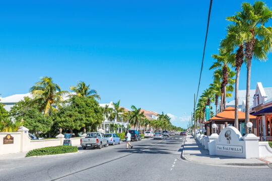
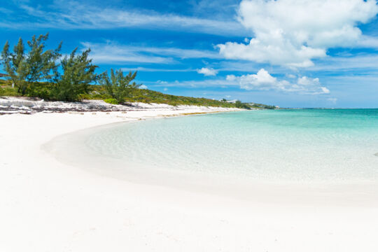
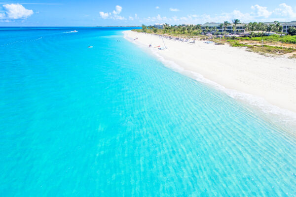
The spectacular Grace Bay. Providenciales does not have a distinct city center or town, as is the case with many other island destinations. However, there are a few central areas. Central Grace Bay is the tourism center on Providenciales, and it's where you can find restaurants , ice cream shops , cafés , beachfront resorts , and most of the island's luxury and souvenir shopping. The Downtown area is the closest approximation to a city center, and although it lacks an organized layout, many government offices and businesses are found here.
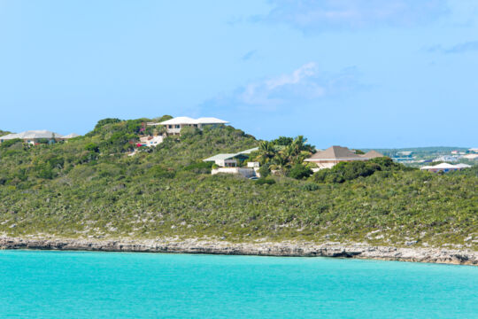
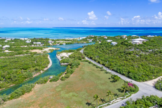
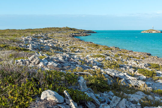
The south coast of Providenciales largely consists of low limestone ironshore coastline, yet inland marine wetlands and ponds (Chalk Sound Lagoon , Juba Sound , Discovery Bay , and Turtle Pond) create semi-isolated peninsulas and coastal regions, many of which have become prime locations for luxury vacation rental villas , including Turtle Tail , Chalk Sound , Silly Creek , and Cooper Jack Bay .
If you’re planning to visit Providenciales and stay at a rental accommodation, see Providenciales Vacation Villas for information on lodging locations from a visitor’s perspective.
The Three Original Settlements The Blue Hills community on Providenciales, which is one of the three original settlements on the island. Prior to the advent of the tourism industry in Providenciales in the late 1970s, the island was home to only three small settlements: Blue Hills , Five Cays , and the Bight . These communities were supported by fishing and subsistence farming.
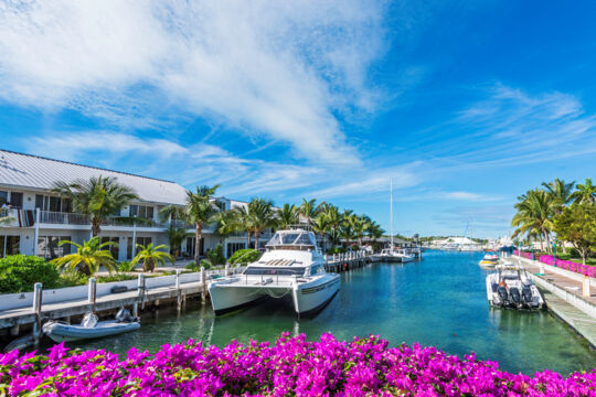
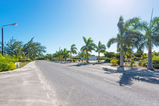
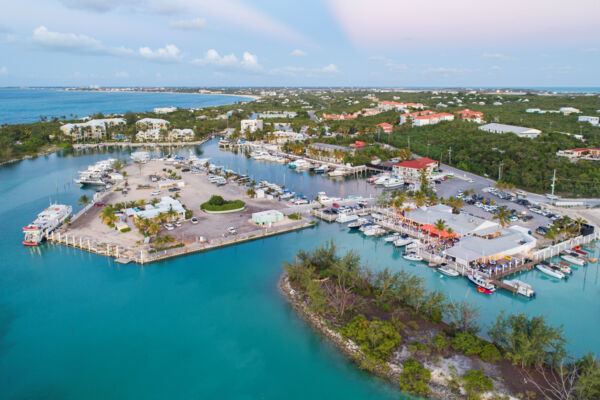
The vacation industry on Providenciales began at Turtle Cove , where the construction of the Third Turtle Inn and the Turtle Cove Marina opened the island to international tourism. It’s interesting to note that the island’s first resort was located here and not on the world-famous Grace Bay Beach .
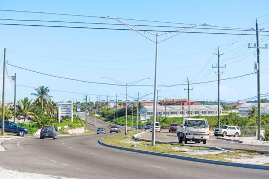
Transport, Getting Around, and Exploring There’s no organized public transport or bus service in the Turks and Caicos, so to get around, you'll either need to rent a vehicle or travel by taxi or private car . To save on vacation costs , it's generally advised to rent a vehicle for the duration of your stay.
For more information on getting around, see Driving in the Turks and Caicos Islands , Providenciales Car Rentals , and Exploring Providenciales .
Areas and Districts Map The map below shows the areas and districts of Providenciales. The colored areas shown below reflect the partitioning of Providenciales used by this site to denote the location of hotels , villas , activities , businesses, and more throughout this website.
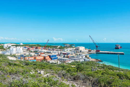
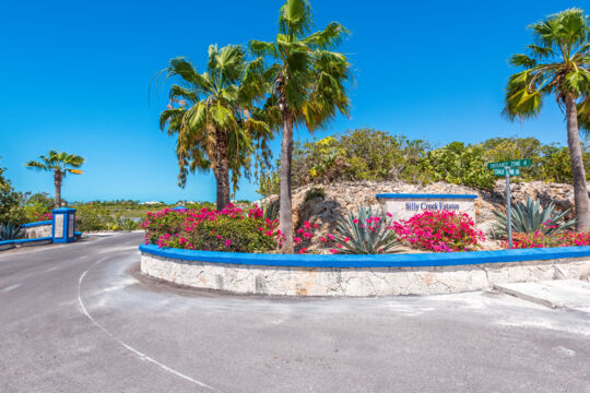
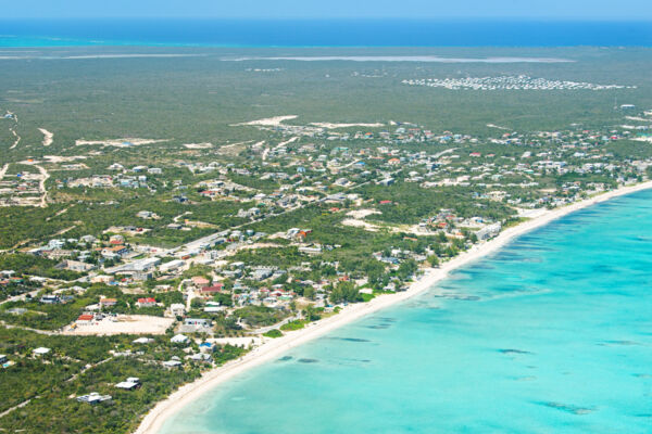
Locations on Providenciales Grace Bay Grace Bay is located on the central northern side of Providenciales, and is the center of tourism, upscale shopping, and dining in the Turks and Caicos. World-famous Grace Bay Beach borders this region, and many of the island’s resorts and hotels are located in the area. Leeward Leeward is an upscale and largely residential region located on the northeast end of Providenciales. The beautiful Leeward Beach fronts the coast here, and the area is home to many luxurious vacation rentals, as well as the expansive Blue Haven Marina. Chalk Sound The Chalk Sound residential region is located on a narrow peninsula of land between the lagoon of Chalk Sound National Park and the shallow Caicos Banks. Many beautiful homes and luxury vacation villas are found here, as well as the sheltered beaches of Sapodilla Bay and Taylor Bay. Long Bay Long Bay is a coastal residential region in southeast Providenciales. The area supports a low density of homes and rental villas. Long Bay Hills is the interior part of this region, and Long Bay Beach lines the south coast. The Shore Club Resort, H2O Resort, South Bank Marina, and a few restaurants are located here. Turtle Cove Turtle Cove is a quiet residential and tourism region located on the central north coast of Providenciales. The area is home to a few hotels, Turtle Cove Marina, several restaurants, and quite a few vacation rentals. The excellent snorkeling site of Smith’s Reef is situated close to the beach here. Turtle Tail Turtle Tail is a highly scenic coastal region in the central south area of Providenciales. This peninsula is largely separated from the mainland of the island by the shallow and beautiful Flamingo Lake and Juba Sound. The region is home to many upscale residences and vacation villas. Blue Hills Blue Hills is a residential community on the northwestern side of Providenciales, and one of the three original settlements on the island. The area is primarily residential, with an array of small shops and restaurants and a scenic coastal road that fronts the original village. Adjacent to the west is the neighboring region of Wheeland. Blue Mountain Found on the central north coast of the island, Blue Mountain is the highest point on Providenciales at 156 feet (47.5 m). Mainly a residential area, a few rental villas and the Rock House resort can be found here. A paved road leads nearly to the summit of Blue Mountain, where excellent views over Blue Hills, Downtown, and the northern barrier reef can be had. Leeward Highway Leeward Highway is the main highway on Providenciales, and runs from the Downtown and airport area to the far eastern end of the island. Many of the island’s larger stores and businesses are located along this four-lane route. Discovery Bay Discovery Bay is found between the Cooper Jack Bay and the Five Cays areas of Providenciales, and supports a community of mixed, light industrial-use businesses and services, homes, and low-density apartments. The southern sections of this region can offer scenic views over Cheshire Hall Creek and the distant Caicos Banks. Downtown Downtown is located in central Providenciales near the airport. Many government offices, the post office, a number of small restaurants and shops, a sports center, and a supermarket are located in this region. The largely residential Kew Town is adjacent to the northwest. Five Cays Five Cays is located on the southern coast of Providenciales, and was one of the three original villages on the island. The settlement is largely residential, with a range of small businesses and shops, and is the center of the fishing industry on the island. The Bight The Bight is a residential community found inland between Grace Bay and Turtle Cove. The settlement is one of the three original villages on Providenciales. Much of the Bight supports low-density residential development, yet small shops, several resorts, a few restaurants, and vacation accommodations are also found in the area. Cooper Jack Bay Cooper Jack Bay is located on the central south coast of Providenciales, adjacent to the Discovery Bay and Venetian Road districts. Several scenic hills in this area offer spectacular views over the shallow and turquoise Caicos Banks. Juba Sound Juba Sound is an often-overlooked area found south of Leeward Highway and adjacent to Turtle Tail and Long Bay Hills. Offering excellent views over Juba Point Salina, this area is mainly residential. Kew Town Located between the Downtown area and Blue Hills, Kew Town is a local residential area with some small shops, restaurants, and businesses. It's a short distance from the airport and the Downtown area. Greater Kew Town Region The Greater Kew Town Region (GKR) roughly describes an area of central Providenciales between Kew Town, Millennium Highway, and Wheeland. It's home to numerous businesses, such as parlors, restaurants, and salons, and settlements. Thompson Cove Thompson Cove is a quiet residential neighborhood located in central Providenciales near Blue Mountain and Blue Hills. This community is fronted by a beach, and has a canal system and a central park open space. Babalua Beach Babalua Beach is a centrally located beach and residential area. The coast is secluded and difficult to find, and consequently sees few visitors. Some decent snorkeling can be found here, yet it isn’t quite up to the quality of nearby Smith’s Reef. Likewise, the water and beach are nice, but are surpassed by many other beaches on Providenciales. Northwest Point The remote and rugged limestone coastline of Northwest Point offers countless small coves and cliffs to explore. The interior ponds here are some of the best birdwatching spots on Providenciales. It's an especially impressive place when the ocean swell is high. South Dock South Dock is found on the southern coast of Providenciales. This industrial region is home to the primary cargo port in the Turks and Caicos. Chalk Sound, Five Cays, and Sapodilla Bay are adjacent to this coastal area. South Dock Road South Dock Road is a region that connects the Downtown and airport area to Five Cays and South Dock. Much of this road and adjacent land supports industrial sites, yet the southwestern section is home to residences and some accesses to the beautiful Chalk Sound lagoon. Venetian Road Venetian Road is a long and winding route that follows along the Turtle Tail peninsula. Commonly, the name refers to the community found off the beginning inland sections of the road, which is primarily residential with two small hotels and a school. As the road continues out to Turtle Tail and past Flamingo Lake, development transitions to upscale homes and vacation villas. Malcolm’s Road Beach Beautiful and remote, Malcolm’s Road Beach offers much to explore. Due to being close to the edge of the Caicos Islands plateau and the deeper water, this beach occasionally experiences breaking surf directly off the coast and has more of a rugged appearance than the other beaches on the island. The adventurous can find great snorkeling here. Heaving Down Rock Heaving Down Rock is on the far eastern side of Providenciales. This region is home to a marina, the landing point for the North Caicos ferry, the Bird Rock hiking trail, and the abandoned Caicos Conch Farm. Richmond Hills Located in central Providenciales, Richmond Hills is a low-density residential area. Private homes and a small school make up most of the development found here. Silly Creek Silly Creek is a small peninsula found near Chalk Sound on Providenciales, and supports luxury homes and vacation villas. The small and winding road that leads through the community travels through limestone bluffs and stunted coastal vegetation, and is quite scenic. Wheeland Wheeland is a residential region on the western side of Providenciales. The area is accessed from Blue Hills and Millennium Highway, and features two separate neighborhoods: Wheeland Settlement and Millennium Heights. 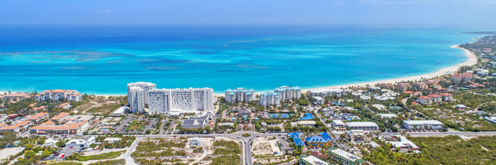
)