
Nongatown Landing Middle Caicos
Nongatown Landing is located between Bambarra Beach and Platico Point, and is a secluded and uninhabited section of coastline.
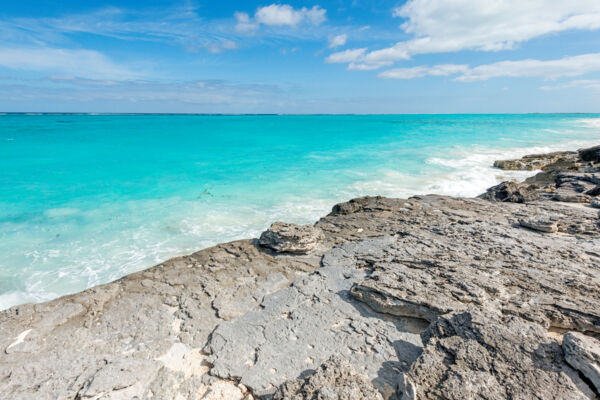
Much of Nongatown Landing is a low marine limestone cliff at the water's edge, but beach gradually takes over to the east.
The water is typically a quite vivid shade of turquoise, and water clarity can be quite good, yet there can be small amounts of floating seaweed and flotsam at times. Some small yet interesting snorkeling sites can be found in the bay between the barrier reef and the coast. Due to the proximity of the edge of the subterranean plateau of the Caicos Islands and the deep Atlantic Ocean, there can be a groundswell and wave break on the reef. A small cut off the bay is accessible by small vessels.
History
Two sets of ruins can be found in the general area.
On the bluff above the coast (about 0.3 miles or 0.5 km inland), the field walls and stone skeleton of Ferguson Plantation still stand. This Loyalist-era site was at one time a successful cotton plantation.
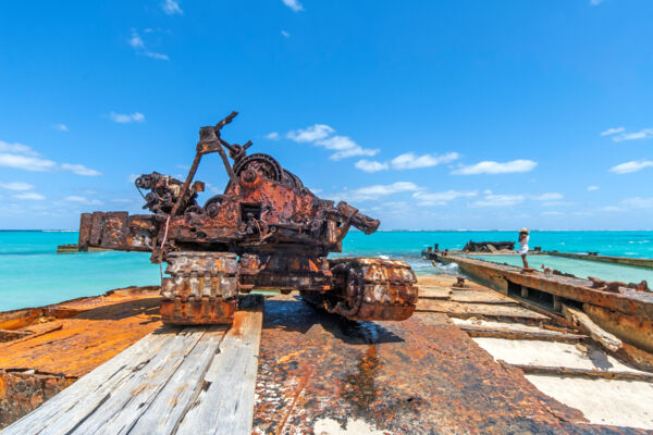
To the west are the few remains of a more modern venture, namely a cargo port. Here, the rusted remains (circa the late 1980s or early 1990s) of a barge, crane, and shipping containers are found. Be aware that the decaying equipment can be hazardous.
Getting Here
The easiest point of access is found on the eastern end of the Conch Bar coastal road. This highly scenic path leads along the top of the bluff fronting Conch Bar Beach and Platico Point. After you pass the crane ruins, simply stop at one of the short bulldozed tracks to the ocean.