
Juniper Hole Middle Caicos
Juniper Hole is a narrow and shallow cut in the reef located between the northwestern point of Middle Caicos and Highas Cay. Historically, this cut was used by vessels transiting to and from the open ocean and the inshore tidal creeks between North Caicos and Middle Caicos. It had the reputation of being quite dangerous to small sailing boats, such as the Caicos Sloop.
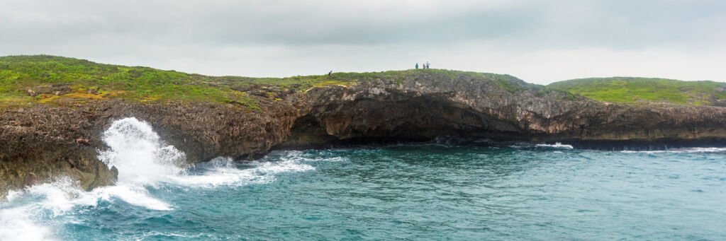
The cut is very narrow and has a route that closely follows the cliffs on Middle Caicos. Throughout history, the combination of the wind disturbance caused by the cliffs, heavy tidal currents, and breaking waves has caused many shipwrecks.
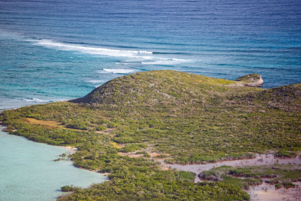
The coastal region near Juniper Hole is quite majestic, and hides secluded beaches, coastal cliffs, and many small caves. When the ocean swell is high, impressive waves can be seen breaking off the coast.
Juniper Hole is mentioned on many maps and charts of Middle Caicos. This fact is largely due to it being an ocean navigational point, rather than a settlement or anything else of importance. The area is quite remote, and there are no roads to Juniper Hole or any development in the region.
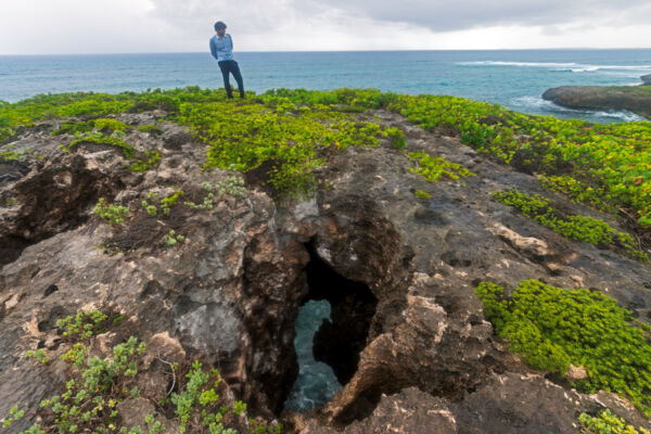
A large open-face ocean cave is found down the coast east of Juniper Hole. This feature is the largest sea cave in the Turks and Caicos and is very scenic. At the peak of the hill above the cave are small skylights that open onto the cave below and are both fascinating and dangerous.
Getting to Juniper Hole
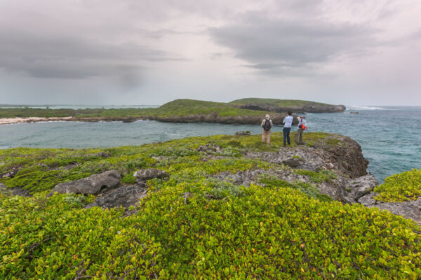
Juniper Hole is quite remote, so the only way to get to the area is to travel via small boat or hike to Juniper Hill (the bluff above the cut) via the Crossing Place Trail. This trail was the traditional route that connected Middle Caicos and North Caicos, with wading points between the channels dividing Middle Caicos, Well Cay, Conch Cay, and North Caicos.
The trail was used for centuries, yet gradually saw less and less use into the 1900s. Now, only the eastern Middle Caicos portion of this route is occasionally visited as a scenic hiking attraction. Some of the exquisite features on the trail include the open beach cave at Mudjin Harbour, Dragon Cay, and the Blowing Hole, which is a hole in the limestone coast connected to the ocean by a short underwater passage.
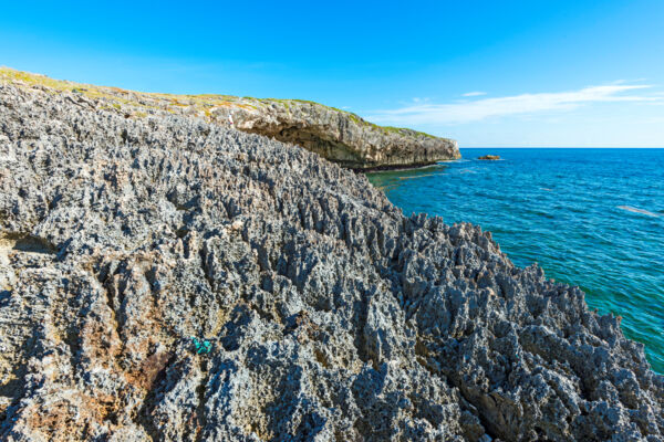
Limestone Ironshore
Another fascinating feature that can be seen in the Juniper Hole area are limestone ironshore formations.
Ironshore is the local name for an intricate and weathered type of coastal limestone rock, which exhibits extravagant and almost cartoonish spikes. The ironshore near Juniper Hole is some of the most distinct in the country, with spikes that can be almost three feet (1 m) tall.
Dangers
Juniper Hole and the Crossing Place Trail are quite remote, and there are many hazards you need to be aware of before visiting.
The Juniper Hole channel is quite shallow, so it's only suitable for small vessels with very shallow draft. Reefs and coral heads are found throughout the area. Beware that the cut is often closed off by the breaking swell and large waves—as a channel system between islands, the cut at Juniper Hole can have a significant tidal current.
Three skylight holes are found at the crest of the bluff over Juniper Hole, with a dangerous drop to the water 40 feet (12 m) below. It’s possible to come across these holes abruptly when hiking, so be aware and exercise caution.
Another consideration is coral sumac, a poisonous type of tree that can cause severe blisters and skin reactions when touched. Coral sumac is very common in the area, and should be avoided.
During rainy periods, mosquitoes can be quite bad near Juniper Hole due to seasonal brackish ponds found in the area. See Mosquitoes in the Turks and Caicos.
How Was the Juniper Hole Cave Formed?
Nearly all caves in the Turks and Caicos were formed by the karst process. The large cave near Juniper Hole likely began as a dry flank margin cave system when ocean levels were higher than they are today. Initially, the cave likely didn’t have a natural opening. Rather, it was probably broken into by the elements or ocean after it was formed.
Evidence of dry cave features can still be seen at the cliff face on Middle Caicos directly adjacent to Juniper Hole, as well as at many other locations on the Mudjin Harbour and Crossing Place Trail coastline. In most cases, these are columns, stalactites, or stalagmites, often with heavy overprinting by the action of the ocean and elements.
Middle Caicos is home to amazing geology and some impressive karst cave features, including Conch Bar Caves (the largest dry cave system in the Bahamas–Turks and Caicos archipelago) and the Middle Caicos Ocean Hole, which is likely the widest blue hole on Earth.