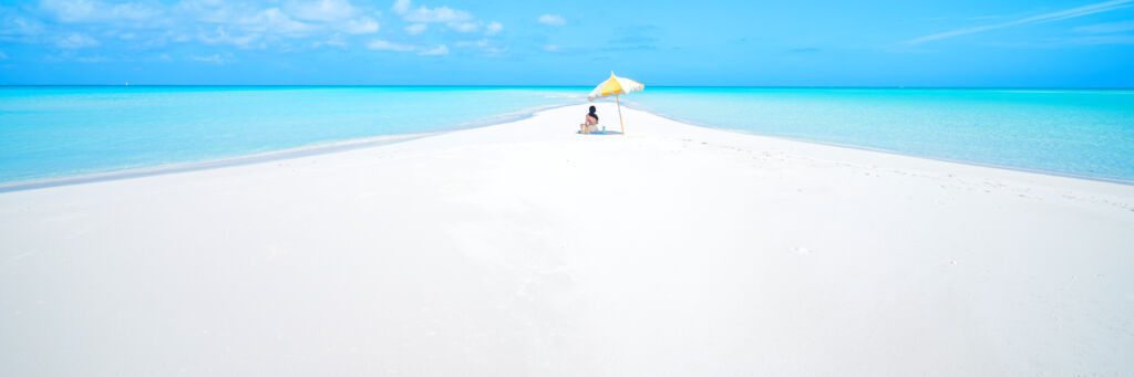
Sandbar near Pine Cay in the Turks and Caicos
Sandbar in the Caicos Cays.
Nothing found. Try changing your search terms.

Turks and Caicos Wind, Wave, Swell & Tide Forecast

Temperature: Wind: Waves: Other Units:
Windspeed (kph)
Wind Gusts (kph)
Wind Direction
Waves (m)
Wave Period (s)
Wave Direction
Tide
Temperature (°C)
Water Temp. (°C)
Clouds (%)
Rainfall (mm)
Today • 18 October
0h
22
23
E
0.7
9
NE
29
28
2
0
1h
21
22
SE
0.7
10
NE
29
28
0
0
2h
21
22
SE
0.7
9
NE
29
28
7
0
3h
20
23
SE
0.7
9
NE
29
28
5
0
4h
22
23
SE
0.6
9
NE
29
28
5
0
5h
22
24
SE
0.6
9
NE
29
28
41
0
6h
22
22
SE
0.7
9
NE
29
28
10
0
7h
22
22
SE
0.7
9
NE
28
28
5
0
8h
21
22
SE
0.7
9
NE
29
28
4
0
9h
21
22
SE
0.7
9
NE
29
28
2
0
10h
18
19
SE
0.7
9
NE
29
28
2
0
11h
17
17
SE
0.6
9
NE
24
28
5
0.7
12h
17
17
SE
0.5
9
NE
25
28
5
0
13h
15
16
E
0.6
8
NE
26
28
5
0
14h
15
17
E
0.5
8
NE
26
28
5
0
15h
17
17
E
0.6
8
NE
27
28
5
0
16h
19
19
E
0.5
8
NE
27
28
5
0
17h
19
21
E
0.5
8
NE
28
28
5
0
18h
21
22
E
0.6
8
NE
28
28
5
0
19h
22
23
E
0.6
8
NE
28
28
5
0
20h
22
23
E
0.6
8
NE
29
28
5
0
21h
22
22
E
0.6
8
NE
29
28
27
0
22h
19
21
E
0.6
10
NE
29
28
93
0.1
23h
17
19
E
0.6
10
NE
28
28
100
1.2
Windspeed (kph)
Wind Gusts (kph)
Wind Direction
Waves (m)
Wave Period (s)
Wave Direction
Tide
Temperature (°C)
Water Temp. (°C)
Clouds (%)
Rainfall (mm)
Monday • 19 October
0h
18
19
E
0.6
10
NE
28
28
93
0
1h
19
21
E
0.6
10
NE
28
28
94
0
2h
19
21
E
0.6
10
NE
28
28
100
0
3h
20
21
E
0.6
10
NE
28
28
100
0
4h
21
21
E
0.6
10
NE
28
28
79
0
5h
19
19
E
0.6
9
NE
28
28
100
0
6h
19
20
E
0.6
9
NE
28
28
100
0
7h
19
20
E
0.5
9
NE
28
28
33
0
8h
19
20
E
0.7
9
NE
28
28
23
0
9h
20
21
E
0.6
12
N
28
28
5
0
10h
19
20
E
0.5
11
N
28
28
5
0
11h
17
18
E
0.9
14
N
24
28
11
0
12h
16
17
E
1
13
N
28
28
26
0
13h
15
16
E
0.5
13
N
26
28
5
0
14h
15
16
E
0.5
13
N
26
28
9
0
15h
17
17
E
0.5
13
N
28
28
99
0
16h
16
17
E
0.5
13
N
28
28
50
0
17h
17
17
E
0.5
13
N
28
28
30
0
18h
19
19
E
0.5
13
N
28
28
40
0
19h
20
20
E
0.8
13
N
28
28
5
0
20h
21
21
E
0.9
13
N
28
28
5
0
21h
21
21
E
0.8
13
N
28
28
6
0
22h
19
20
E
0.8
13
N
28
28
67
0
23h
19
19
E
0.8
13
N
28
28
99
0
Windspeed (kph)
Wind Gusts (kph)
Wind Direction
Waves (m)
Wave Period (s)
Wave Direction
Tide
Temperature (°C)
Water Temp. (°C)
Clouds (%)
Rainfall (mm)
Tuesday • 20 October
0h
19
19
E
0.7
13
N
28
28
19
0.2
1h
17
18
E
0.7
13
N
28
28
24
0
2h
16
17
E
0.7
13
N
28
28
9
0
3h
16
16
E
0.7
13
N
28
28
9
0.1
4h
16
16
E
0.8
13
N
28
28
8
0
5h
18
25
E
0.8
13
N
28
28
5
0
6h
19
25
E
0.9
13
N
28
28
50
0
7h
19
25
E
0.8
13
N
28
28
5
0
8h
18
24
E
0.8
13
N
28
28
4
0
9h
17
18
E
0.8
13
N
28
28
5
0
10h
17
19
E
0.7
13
N
28
28
16
0
11h
15
15
E
0.7
13
N
28
28
42
0
12h
15
15
E
0.7
12
N
27
28
15
0
13h
14
15
E
0.6
12
N
24
28
5
0
14h
13
14
E
0.6
12
N
28
28
40
0
15h
13
13
E
0.6
12
N
28
28
57
0
16h
14
15
E
0.6
12
N
28
28
100
0
17h
15
16
NE
0.6
12
N
28
28
100
0
18h
17
17
NE
0.6
12
N
28
28
41
0
19h
18
25
NE
0.7
12
N
28
28
99
0
20h
19
20
NE
0.7
12
N
28
28
29
0
21h
21
21
E
0.7
12
N
28
28
6
0
22h
20
23
E
0.6
12
N
28
28
5
0
23h
17
17
E
0.6
12
N
28
28
58
0.7
Windspeed (kph)
Wind Gusts (kph)
Wind Direction
Waves (m)
Wave Period (s)
Wave Direction
Tide
Temperature (°C)
Water Temp. (°C)
Clouds (%)
Rainfall (mm)
Wednesday • 21 October
0h
16
17
E
0.5
12
N
28
30
100
0.8
1h
16
16
E
0.3
12
N
28
30
8
0
2h
13
14
E
0.5
11
N
28
30
100
0
3h
16
17
E
0.5
11
N
28
30
100
0
4h
17
17
E
0.6
11
N
28
30
100
0
5h
17
17
E
0.4
11
N
28
30
100
0
6h
17
18
SE
0.4
11
N
28
30
100
0
7h
15
17
SE
0.4
11
N
28
30
100
0
8h
16
17
SE
0.4
11
N
28
30
100
0.5
9h
17
17
SE
0.4
11
N
28
30
40
0
10h
15
15
SE
0.6
11
N
28
30
100
0
11h
12
13
SE
0.6
11
N
28
30
100
4.3
12h
13
13
SE
0.6
11
N
28
30
42
0
13h
12
12
SE
0.5
11
N
25
30
5
2
14h
10
10
SE
0.5
11
N
26
30
1
2
15h
10
10
SE
0.5
11
N
26
30
2
2.4
16h
11
18
SE
0.5
11
N
26
30
1
1.3
17h
12
16
SE
0.5
11
N
27
30
0
0
18h
9
10
SE
0.5
11
N
27
30
0
0
19h
8
9
SE
0.5
11
N
28
30
0
4
20h
10
11
SE
0.5
11
N
28
30
1
1.1
21h
13
15
SE
0.5
11
N
28
30
1
0
22h
13
14
SE
0.5
11
N
28
30
5
0.3
23h
12
13
SE
0.4
11
N
28
30
1
1.2
Windspeed (kph)
Wind Gusts (kph)
Wind Direction
Waves (m)
Wave Period (s)
Wave Direction
Tide
Temperature (°C)
Water Temp. (°C)
Clouds (%)
Rainfall (mm)
Thursday • 22 October
0h
12
13
SE
0.4
11
N
28
30
4
0.7
1h
13
14
SE
0.3
11
N
28
30
1
0
2h
12
13
SE
0.2
11
N
28
30
5
0
3h
9
10
SE
0.2
11
N
28
30
0
0
4h
10
11
SE
0.2
11
N
28
30
0
0
5h
10
10
SE
0.2
11
N
28
30
0
0
6h
11
14
SE
0.2
11
N
28
30
0
0
7h
11
12
SE
0.1
11
N
28
30
0
0
8h
10
11
SE
0.1
11
N
28
30
0
0
9h
10
10
SE
0.1
11
N
28
30
0
0
10h
10
11
SE
0.1
12
N
28
30
0
0
11h
12
13
SE
0.1
12
S
24
30
1
0
12h
12
19
SE
0.1
12
S
25
30
13
0
13h
11
11
SE
0.1
12
N
28
30
17
0
14h
11
12
SE
0.1
12
N
27
30
11
0
15h
12
13
SE
0.1
12
N
27
30
6
0
16h
12
13
E
0.1
12
N
27
30
0
0
17h
13
15
SE
0.2
12
N
27
30
33
0
18h
15
17
SE
0.2
12
N
28
30
67
0
19h
17
18
SE
0.2
12
N
28
30
100
0
20h
21
23
SE
0.3
12
N
28
30
100
0.7
21h
24
27
SE
0.4
12
N
28
30
100
1.3
22h
28
32
SE
0.5
12
N
28
30
100
2
23h
29
32
SE
0.6
12
N
28
30
100
1.3
Windspeed (kph)
Wind Gusts (kph)
Wind Direction
Waves (m)
Wave Period (s)
Wave Direction
Tide
Temperature (°C)
Water Temp. (°C)
Clouds (%)
Rainfall (mm)
Friday • 23 October
0h
30
33
SE
0.6
12
N
28
30
100
0.7
1h
31
33
SE
0.7
12
N
28
30
100
0
2h
32
35
SE
0.9
13
N
28
30
100
0
3h
32
36
SE
1
14
N
28
30
100
0
4h
33
37
SE
1.2
14
N
28
30
100
0
5h
33
37
SE
1.3
14
N
28
30
100
0.3
6h
32
36
SE
1.3
14
N
28
30
100
0.5
7h
32
35
SE
1.4
14
N
28
30
100
0.8
8h
34
35
SE
1.4
14
N
27
30
100
0.7
9h
35
36
SE
1.3
14
N
27
30
100
0.5
10h
36
36
SE
1.3
13
N
27
30
100
0.4
11h
37
38
SE
1.3
13
N
27
30
100
0.4
12h
39
40
SE
1.3
13
N
26
30
100
0.5
13h
40
42
S
1.2
13
N
26
30
100
0.5
14h
41
43
S
1.2
13
N
26
30
100
0.6
15h
41
44
SE
1.1
13
N
27
30
100
0.7
16h
42
45
SE
1.1
13
N
27
30
100
0.8
17h
42
45
SE
1
12
N
27
30
100
0.5
18h
43
46
SE
1
12
N
27
30
100
0.3
19h
44
46
SE
0.9
12
N
27
30
100
0.1
20h
46
48
SE
1.1
12
N
27
30
100
0.1
21h
48
50
SE
1.2
12
N
27
30
100
0.1
22h
50
52
SE
1.3
12
N
27
30
100
0.1
23h
49
50
SE
1.4
12
N
27
30
100
0.4
Windspeed (kph)
Wind Gusts (kph)
Wind Direction
Waves (m)
Wave Period (s)
Wave Direction
Tide
Temperature (°C)
Water Temp. (°C)
Clouds (%)
Rainfall (mm)
Saturday • 24 October
0h
47
48
S
1.5
12
N
27
30
100
0.7
1h
46
47
S
1.7
12
N
27
30
100
1
2h
47
49
S
1.6
12
N
27
30
100
1.1
3h
49
52
SE
1.5
12
N
27
30
100
1.1
4h
50
55
SE
1.4
12
N
27
30
100
1.2
5h
46
50
S
1.1
10
N
27
30
95
0.8
6h
42
44
S
0.9
8
N
27
30
91
0.4
7h
38
38
S
0.6
7
N
27
30
86
0
8h
33
35
S
0.6
8
N
27
30
91
0
9h
29
31
S
0.6
10
N
27
30
95
0.1
10h
24
27
S
0.5
11
N
27
30
100
0.1
11h
23
25
SW
0.5
11
N
27
30
100
0.5
12h
21
23
SW
0.4
11
N
27
30
100
0.8
13h
19
22
SW
0.4
11
N
27
30
100
1.2
14h
19
21
W
0.7
11
N
27
30
100
0.8
15h
19
21
W
1
11
N
27
30
100
0.4
16h
19
20
NW
1.3
11
N
27
30
100
0
17h
17
18
NW
1.2
11
N
27
30
95
0
18h
14
15
NW
1.1
11
N
27
30
91
0
19h
12
13
NW
1
11
N
27
30
86
0
20h
12
14
NW
1
11
N
27
30
91
0
21h
12
15
NW
0.9
10
N
27
30
95
0
22h
11
16
NW
0.9
10
N
27
30
100
0
23h
11
15
NW
0.8
10
N
27
30
100
0

The Wind and Breeze

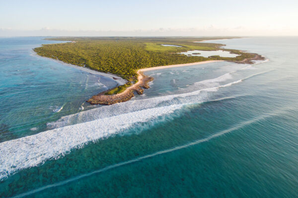
Rolling waves at the Northwest Point National Park on Providenciales
The break at Northwest Point, Providenciales.

Throughout the year, the Turks and Caicos typically experiences an east-southeast trade wind, with wind speeds in the 12–20 mph (19–32 km/h, or 10–17 knots) range.

Passing storms and squalls do shift wind directions at times, and excluding the rare tropical cyclone, such storms are typically seen during the winter months.

The Tide Forecast

As Turks and Caicos is located in the tropical Atlantic, the high-to-low tide change difference (or tidal range) does not tend to be drastic, with a typical tide height change of about 1.9–3 feet (0.6–1 m). Abnormal tides, such as spring tides, may cause unusual lows and highs, yet these are never extreme.

Neap tides, experienced when the sun and moon are at right angles to each other (from the perspective of the Earth) and their gravitational pulls partially cancel each other out, tend to create the least tidal range and conditions that allow for the best underwater visibility, which is perfect for snorkeling and diving.

Keep in mind that many tide forecast websites base their island-specific Turks and Caicos tide table on harmonic predictions at Sandy Point on the island of North Caicos, and simply apply a slight modifier calculation to create a forecast level for each of the islands. This does not take into account the extensive and shallow Caicos Banks off the south of the Caicos Islands, which tend to delay tide changes at many adjacent coastal areas as water moves in and out of the banks.

The coastal areas on the Caicos Banks can be quite shallow in places, and many popular routes may not offer much extra draft for the common watercraft, especially at lower tide levels. It's recommended that you use accurate marine navigation charts.

Waves and Breaks

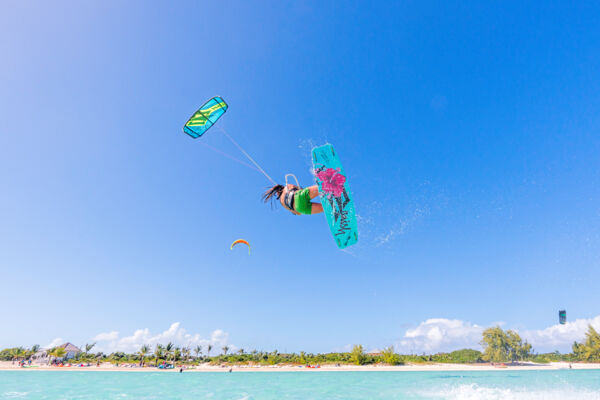
High kiteboarding jump at Long Bay Beach on Providenciales
Perfect kiteboarding conditions at Long Bay Beach, Providenciales.

The Turks and Caicos generally doesn’t experience the huge waves that some other tropical destinations, such as Hawaii, Barbados, and Puerto Rico, see at times.

The ocean topography of the plateaus supporting the islands largely accounts for the lack of significant waves. Regions that do experience large breaks usually have complex submarine terrains that essentially funnel the open ocean swell to specific areas, where a gradually sloping ocean floor allows the waves to stack into a tremendous break.

The Turks and Caicos Islands, however, sit on two distinct shelves (the Turks Islands group and the Caicos Islands group) that have a rather abrupt transition from the surrounding 10,000-foot (3,000 m) Atlantic Ocean floor to the very shallow water on top of the plateaus. While it supports unparalleled wall diving, the country's ocean topography does not lend itself well to large wave formation.

The best place in the country to watch the full glory of large breaking waves is either Northwest Point National Park on Providenciales or Mudjin Harbour and the Crossing Place Trail on Middle Caicos. Keep in mind that wave conditions are flat more often than not. These locations are great spots for watching the sunrise and sunset, which are typically just as impressive as the swell.

Water Sports

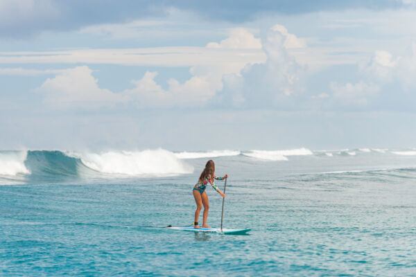
Stand-up paddleboard surfing at West Reef in the Turks and Caicos
Stand-up paddleboard surfing on the Caicos barrier reef.

Amazing flat-water kiteboarding can be had at many locations throughout the Turks and Caicos. Due to the trade wind directions, the best kite spots are typically southeastern-facing beaches on the south sides of the islands. The best such example is the popular Long Bay Beach on Providenciales, which is one of the top kiting locations in the region.

On the occasional days that see a northerly breeze, the spectacular north coasts and beaches become a bit more viable for kiting.

For the kiteboarding hotspot of Long Bay Beach on Providenciales, 20–30 mph (32–48 km/h) with an east-southeast direction is ideal kiting wind. For South Caicos, Grand Turk, and Salt Cay, kiting wind speed may be a little lower due to the lack of wind obstructions. See Turks and Caicos Kiteboarding for more information on this sport and the best kite spots.

Great flat-water spots for wakeboarding or tubing can typically be found between the channels and cays, regardless of wind or wave conditions.

The Turks and Caicos does not have a reputation for being a surfing destination, simply due to the unpredictability and inconsistency in the breaks. At times, the islands do see wonderful surfing waves, but the quality of the waves hinges heavily on the swell direction. The conditions on the barrier reef off the Caicos Islands may easily become messy.

Although a little more difficult to access from the surfer’s perspective, Grand Turk does see a better break at some offshore sites.