Turks and Caicos Rainfall Information
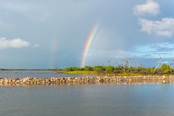
Fortunately for visitors enjoying the sun (and unfortunately for local farmers), the Turks and Caicos receives little rainfall. Unlike in many wetter regions, rain in the Turks and Caicos often only occurs for brief periods in the later afternoon, interrupting an otherwise sunny day.
Our advice is to not worry when you see a little rain in the forecast. In many cases, you won't even notice the rainfall, as it tends to occur in isolated locations rather than as country-wide or island-wide precipitation.
Rainfall vs. Rainy Days
Based on a 10-year sample of data between 2006 and 2016, the average number of days with rain each year on Providenciales is around 43, or about every 8.5 days. However, much of this rainfall occurs during the rainy season from May to November.
)
Rainfall Patterns
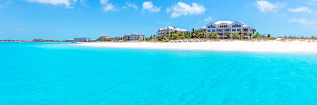
Regional rainfall patterns are quite observable in Turks and Caicos, and as a small tropical country consisting of islands with limited landmass, precipitation is predictably low.
North Caicos, Parrot Cay, and Pine Cay have a reputation for being the “green” islands in the country, and rainfall patterns definitely confirm this fact.
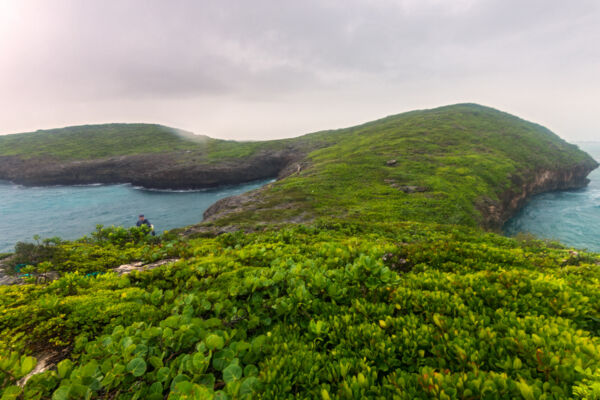
The extensive marine wetland flats on the south sides of East Caicos, Middle Caicos, and North Caicos largely account for this. Consisting of dark saline mud and gray marine limestone, the ground cover on the flats retains quite a bit of the sun’s intense heat. This in turn warms the surrounding humid air. As the air rises, it condenses into rain at cooler and higher altitudes. Due to the constant east-southeast trade wind patterns, this rain typically falls on and to the north of North Caicos, and on the small nearby cays.
When it occurs, this rain usually falls a few hours after midday. By late afternoon, conditions are often clear and sunny.
Although not quite as predictable due to its smaller area, the central west coast region of Providenciales also experiences predictable precipitation. Along with several freshwater ponds, trees that are larger than what is typical to the island are found here, including the sabal palm, West Indian mahogany, and buccaneer palm.
The small islands of Grand Turk and Salt Cay, located on the far eastern edge of the Turks and Caicos, don’t have the advantage of geography that the Caicos Islands have, and consequently see far less rainfall.
Flooding in the Turks and Caicos
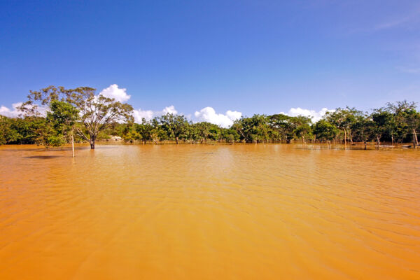
Although annual rainfall in the Turks and Caicos is one of the lowest in the region, flooding does occur at times and is largely confined to relatively few distinct areas in the country.
Generally a byproduct of tropical depressions during the summer and autumn hurricane season, such floods often result in quite significant rainfall over a short period of time. In some cases, areas may experience more than a third of their expected annual rainfall over a matter of days.
Due to the marine limestone geomorphology of the country, the low rolling hills and small valleys of the larger islands' interiors can hold water for weeks—however, natural drainage routes and karst features typically reduce the duration of flooding.
Regions near the ocean, where much of the development in the country is located, usually have either direct natural drainage to the ocean or porous sandy ground that doesn’t hold water.
Regions at Risk of Flood
Several populated areas in the Turks and Caicos are at risk of flood, although floods solely from precipitation are more of an inconvenience for road travel rather than an actual danger.
Mudslides and flash floods—events resulting from rainfall that typically account for most fatalities during flooding in other regions—are not experienced in the Turks and Caicos due to the small islands and low rocky terrain.
During heavy rains, Downtown, The Bight, Five Cays, Grace Bay, and Leeward on Providenciales typically experience flooding in roads and low elevation areas of up to 1 to 2 feet (0.3 to 0.6 m) in depth. The small settlement of Kew on North Caicos usually experiences the worst flooding, with some low points near the village seeing more than 10 feet (3 m) of standing water.
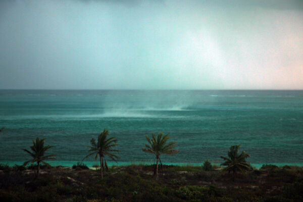
Due to the very low elevation of many settlements and development in the Turks and Caicos, flooding from hurricane storm surge is a real and far greater danger, with the potential for widespread destruction.
While hurricanes are not particularly common in the Turks and Caicos, the country has been hit by several major storms in its history. Hurricane Irma and Hurricane Maria in 2017 were the most recent severe storms to affect the country, and caused substantial flooding. Major storms can cause catastrophic flooding.
Mosquitoes
Mosquitoes are often a problem on the larger Caicos Islands after heavy rains. Due to the prevailing breeze, Providenciales typically only sees mosquito blooms for a few weeks after a storm. Mosquito problems after heavy rains on North Caicos, Middle Caicos, and Pine Cay often persist for quite a bit longer.