
Dick Hill Creek and Bellefield Landing Pond Nature Reserve North Caicos
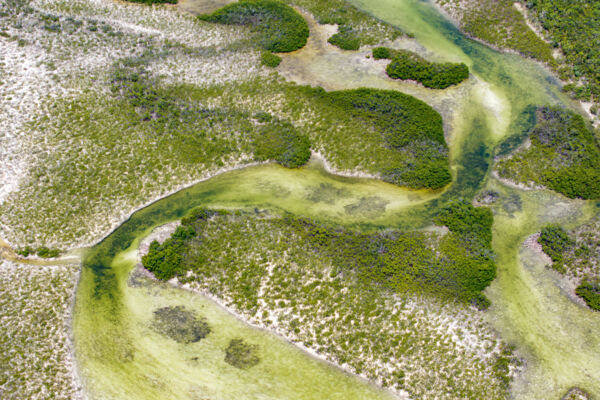
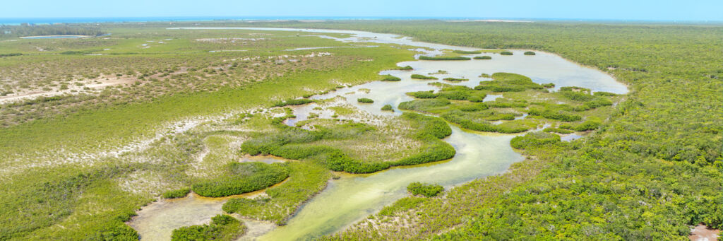
Dick Hill Creek Nature Reserve is a 991-acre (401 hectare) protected area located on the western coast of North Caicos, and near the Bellefield Landing port. The area primarily includes intertidal creeks and the shallow interior marine Bellefield Landing Pond. Red mangroves line many of the channels in the area, and the adjacent wetland flats support a mix of both red mangroves and black mangroves, albeit at a lower density. The nature reserve has the designation NR15 in the Turks and Caicos Islands protected areas system.
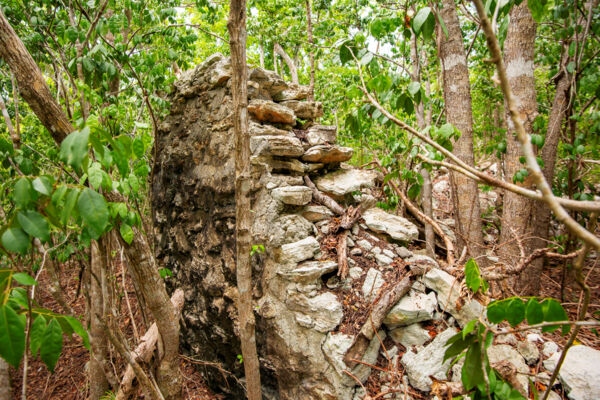
The nature reserve is named after Dick Hill, which is a small and distinct hill located directly on the banks of the salina. Lewhy Moore Plantation, a Loyalist agriculture site, was located at this hill. The plantation had a small rock jetty landing on the creek at the foot of the elevation, the slight remnants of which can still be seen today.
The protected area is an important sanctuary for both marine and birdlife. Wading birds such as reddish egrets and stilts are common, and green herons and yellow-crowned night herons are also regular sights in the transitions between the tropical dry forest and the wetlands on the fringes of the wetlands. On the water side, the area shelters bonefish and turtles, and also serves as a nursery for an array of marine life. The area is also important for the blue land crab (Cardisoma guanhumi), as prime locations for their burrows, typically in the supratidal zone, are for the most part difficult for poachers to access.
During the Loyalist days beginning in the late 1700s, the center of cotton planting was the fertile land between Sandy Point and Kew, located to the east of the nature reserve. This region was home to several plantations, including Teren Hill Plantation, St. James Plantation, Lewhy Moore Plantation, and the famous Wade’s Green, which is the finest plantation site in the country that is open for tourism. Several of these plantations had access to Dick Hill Creek.
The Stone Wall
In the northern reaches of Bellefield Landing Pond, a low rock causeway or wall, likely from the Loyalist era, crosses the pond, and the purpose of this is unclear. This wall would have been in no way sufficient to be a dividing wall for a salina for salt production. It also doesn’t make sense from the perspective of providing access across the pond, as it leads to what was a dense mangrove wetland. Accessing the coast along the pond to the north or south would be far easier. Perhaps it was an attempt to enclose an area for containing or raising sea life such as turtles or fish. Near the mainland at this feature are smaller rock enclosures indicative of conch crawls, which were commonly used to keep live queen conch in until harvesting.
The North Caicos Yacht Club
To the west of Dick Hill Creek is an extensive network of canals that were dug into the wetlands. This residential development was initially named The North Caicos Yacht Club, and was essentially stalled for more than a decade, with only a few houses being constructed inside the project. In recent years, part of this development has been revived under The Channels name.
The dug canals created somewhat of a connection between the interior pond and the large Parrot Cay Channel that separates North Caicos from Parrot Cay, which has altered the past natural tidal water movement in the area. This small connection continues to grow in width and depth, and it’ll be interesting to see how it affects the water flow and southern channels in the coming years.
Environmental Concerns
Many of the protected areas in the Turks and Caicos are under threat, and the Dick Hill Creek Nature Reserve certainly isn’t an exception.
One major consideration are derelict barges and tugboats that have been abandoned and sunk near the primary inlet into the nature reserve. Despite the establishment of an office for the Ports Authority (the government department tasked with overseeing wrecks and ports) nearby at Bellefield Landing within 1,000 feet (250 meters) of these wrecks, it appears that these will be permanent fixtures until they inevitably disintegrate due to corrosion sometime in the latter part of this century. Likewise, the Department of Environment and Coastal Resources (DECR), which is tasked with issues pertaining to the environment and is the primary entity in charge of protected areas in the country, hasn't taken meaningful action regarding the potential for contamination of the environment by petroleum products and other hazardous materials.
Poaching is another issue, although it’s not conducted at the level that occurs in many of the other protected areas in the country, largely due to the more limited presence of the species typically targeted by poachers. Occasional harvesting of fish such as small snappers occurs, as well as the placing of fish traps.